Showing posts with label Aboriginal culture. Show all posts

Jan 21, 2016

Bantry Bay - Timbergetters Track

This walk is on the eastern side of Bantry Bay, Middle Harbour, within Garigal National Park.
We started at Seaforth Oval, with a steep descent down the historic 'Timbergetters Track', to the shore of Bantry Bay. Here our walk leader told us some of the history of the area.

Bantry Bay, Middle Harbour, Sydney

The buildings we could see along the shoreline on the other side of the bay, were part of the Bantry Bay Explosives Magazine complex, dating back to 1906, and in use up until 1974. The area was suitable because it was isolated, and to me it still has a feeling of isolation.
By the early 1900s, the area on the eastern side, where we were standing, was a popular picnic and recreation area, complete with a dining room and dance hall.


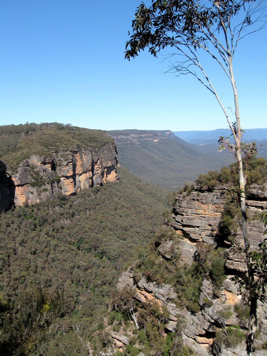
               (below) Great view, but shade was a bit scarce at the Bluff, where we ate lunch

The Bluff, Bantry Bay


Shell middens along the shoreline and rock engravings nearby, point to the past Aboriginal occupation of the area.


We followed the Bay track, the Bluff track and part of the Natural Bridge track, back to the Wakhurst Parkway. Latter we caught a route 136 bus back to the City.


        Location map                           Wildwalks link:  Timber Getters Track  


Oct 19, 2012

Bonnie Doon Cliff Walk

We started this Katoomba walk at the Explorers Tree near the Great Western Highway, at Nellies Glen Road, about 2.5Km from the railway station.

View from Norths Lookout, Katoomba
Nellies Glen Road, which we turned off to follow this cliff top walk, leads to the start of the 'Six Foot Track' and into the valley. Our walk featured Norths Lookout, which overlooks Nellies Glen and the Megalong valley.


Returning to the town centre through Catalina Park (Walford Park) we saw what remains of the Catalina Racing Circuit (below left), which closed in the 1990s. It has a disturbing history, as in 1957 "the traditional owners were forcibly removed from the Gully to make way for a racetrack". This site, known as 'The Gully' was declared an official Aboriginal Place in 2002.


Enlarged photos of the sign the walkers are reading

Location map

WildWalks link


Our thanks, as always, go to our walk leaders.

Sep 3, 2012

Glenbrook Creek to Red Hands Cave

To vary this well known walk in the lower Blue Mountains, our group descended to Glenbrook Creek down the steep slope from the West Glenbrook Nature Reserve (below left).


We followed the creek (above right) to the causeway. The track along the creek was overgrown until after Blue Pool, and although its picturesque, you don't have to reach the causeway by this route.     (see the links at the bottom of the page).

                  
                                      Glenbrook Creek (above)     Campfire Creek (below)


From the causeway we walked the Campfire Creek track to Red Hands Cave, before returning to the station along Bruce Road via the park entrance.      


             Location map

    NSW National Parks: Red Hands Cave            Wildwalks link     


May 27, 2011

Kings Tableland - Wentworth Falls


Bushwalking in the Blue Mountains on cloudy or misty days can yield some interesting variations from those photos taken on sunny days. On this walk, we started from Wentworth Falls station and followed Darwins Walk, to cross Jamison Creek above Wentworth Falls, then onto Kings Tableland.


An Acacia sp.(left) growing in tough windswept conditions on the edge of Kings Tableland.
The Kings Tableland area is known as a ancient Aboriginal cultural site, with some artefacts from a cave having been dated to 25,000 years old.

Kings Tableland above Jamison Valley


Creek crossing above Wentworth Falls


Queens Cascade (left) on Jamison Creek, just above Wentworth Falls.


            Location map


'Wildwalks' information 


Our thanks to John Masser our walk leader

Dec 9, 2010

Parramatta River at Parramatta

Barry Wilde Bridge, Parramatta

These three bridges near the city's centre, cross a short stretch of the Parramatta River above the Charles Street weir, 19Km upstream from Port Jackson.

The bridge in the photo above was named after a former mayor and state politician. The pathway in the foreground is part of the 'Riverside Walk' which leads from the ferry wharf  to the 'Heritage Centre' next to Lennox bridge. Through art and interpretive signs it tells the aboriginal history of the area.


The Elizabeth Street footbridge is an award winning cycle and foot bridge which features an interesting public artwork .

'Wake' by Greg Stonehouse and Susan Milne was inspired by "the gliding movement of oars" and the "flight of birds".


      Lennox bridge (below) was designed by the colony's first Superintendent of Bridges, David Lennox.
It has since been modified but was originally completed in 1839.

Lennox Bridge, Parramatta


                                            See also my 'RiverCat' and 'Parramatta Park' posts     
 
  Location map              Additional photo of footbridge


Aug 26, 2010

Hazelbrook (2)

Aboriginal Wells, Hazelbrook

These rock holes, known as the Aboriginal wells, are adjacent to the Great Western Highway just west of the Hazelbrook village shops. The rock holes, which vary in size are natural or formed holes in the rock.


The rock holes, near Gloria Park, are the remaining group of a larger cluster of holes said to be rainwater catchment wells used by travelling Darug and Gundungurra people. Smaller holes could be covered with capping stones to reduce evaporation.
The elevated pedestrian  footpath goes around the wells which can be seen in the bottom right-hand corner of the above photo.

----------------------------------------------------

Blue Mountains Gazette reported (Nov 19 2013) that: "Selwood Science and Puzzles is closing down after 16 years following the sudden and unexpected death in May of its creator David Thomson".