Showing posts with label Sydney Harbour. Show all posts

Jan 10, 2016

Cremorne Point Walk

It's a quite time for our walking group over the Summer holiday period, so I thought this scenic walk which follows the shoreline path around Cremorne Point would be a good one to try. The reserve with its varied views of Sydney Harbour, has been a popular picnic spot since the early 1900s, and still has many good spots to stop and eat lunch.


Following the path from Bromley Ave, which leads through this pocket of rainforest, I extended the walk around to Mosman Bay wharf.

I wasn't concerned with the wait for the next ferry, as there was a small cafe at the wharf.

Corner Beach, Mosman Bay.


I caught the F6 ferry from Circular Quay, then caught the waiting bus up Milson Rd., to the stop near Prior Av. This allowed me to complete the circuit (~3km), then continue on to Mosman Bay wharf (~1km), with only the link along Hodgson Ave overlapping. (see map)

Dianella caerulea (Flax Lily)


Wildwalks links:
 Cremorne Point circuit           
 Cremorne Point to Mosman wharf

Sep 11, 2015

The Spit to Manly

This popular walk from The Spit Bridge, Mosman, meanders around the harbour foreshore of Clontarf, through part of Sydney Harbour National Park, to Fairlight and Manly.

The Spit Bridge, Middle Harbour
The Spit Bridge (completed in 1958) opens several times each day to allow the passage of tall-masted vessels.


This scenic 10 Km walk has numerous entrance/exit points which would enable a shorter walk.

We caught a bus from the city and returned by ferry.


          The Manly Scenic Walkway   map and info

           Walking Coastal Sydney also has a good pdf with map and notes

            WildWalks link


Feb 19, 2015

Birchgrove Wharf to Ballast Point Park


Balmain East

The photo above was taken from the ferry as we approached Birchgrove wharf on our trip from Circular Quay. Yurulbin Park (below) with its rocky outcrops and native garden beds adjoins the wharf.

Yurulbin Park
(below) A short walk along Louisa Rd led us to Birchgrove Park.


(left) This is one of the houses that caught my eye as we walked along Wharf Road.


The Ballast Point site was purchased in 1928 for use as an oil terminal. Over time the company, which latter became Caltex, built 30 storage tanks at the Balmain terminal.


Caltex sold the site for development in 1997, with a provisional completion date of 2005. After a major campaign by residents, to preserve this and other foreshore sites for public use, the Sydney Harbour Foreshore Authority, on behalf of the Carr State Government, purchased the site in 2002 for use as public open space. The lookout below offers great harbour views.


        Location map


        More photos of Ballast Point


It was only a 2 to 3km walk from Birchgrove Wharf to Balmain Wharf, via Ballast Point Park and  Mort Bay Park.

 My thanks to Jean who led us on this walk.                          Reference           
a

Jan 10, 2015

Hermitage Foreshore Walk & Vaucluse House

The Hermitage Foreshore track begins at Bayview Hill Road or Nielsen Park, Vaucluse and is part of Sydney Harbour National Park.

Hermit Point, Vaucluse
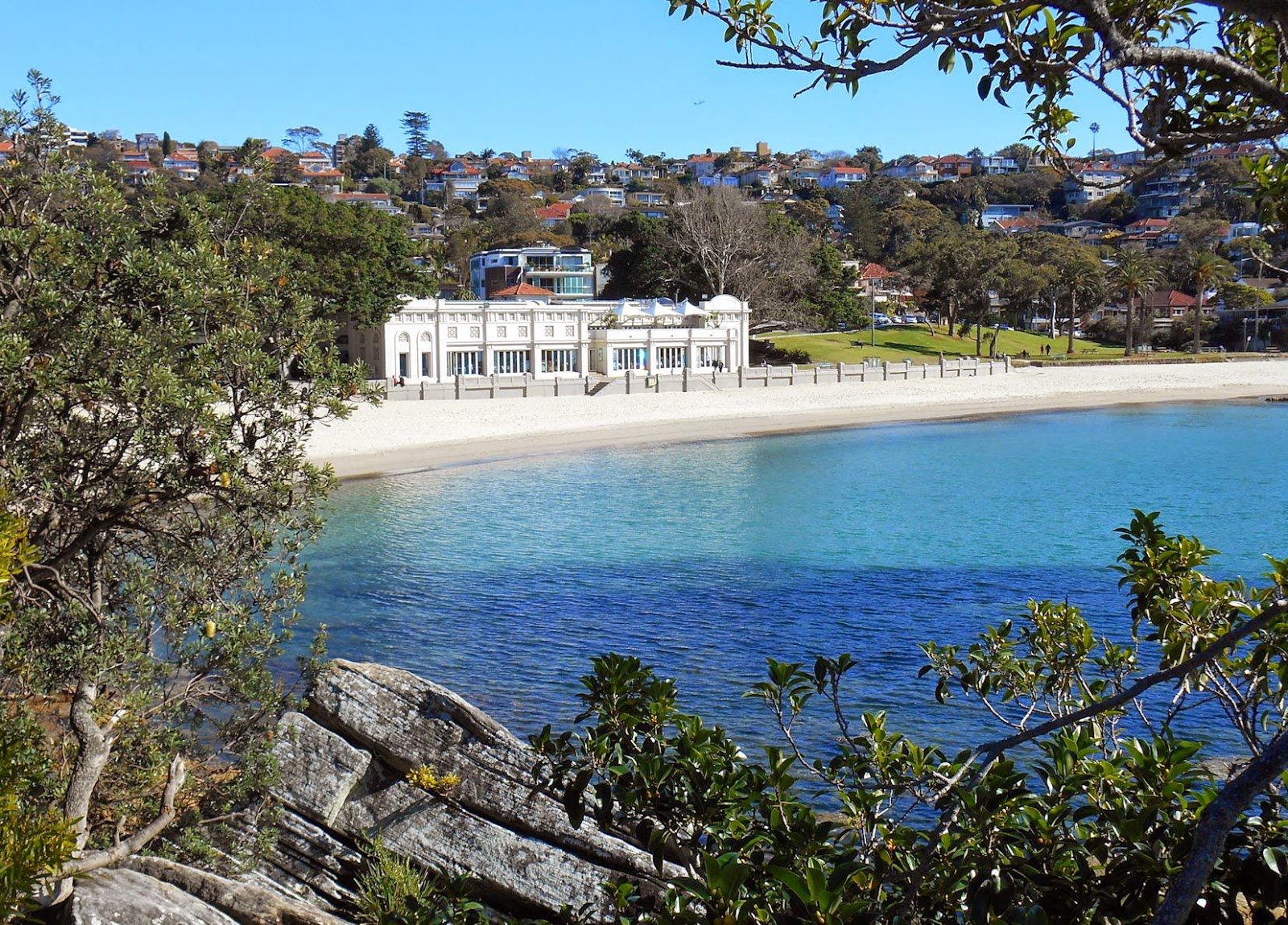
Queens Beach


Our group stopping off at Vaucluse House, the sandstone mansion, built in the 1830s, for William Charles Wentworth and his family.
 
I was familiar with the front view of Vaucluse House (see Nielsen Park post), but found much more to see as we were led around to the back of the house beyond the 'castle' facade.

I saw inside on a previous visit, and thought it was well worth the visit. (Vaucluse House link)


Vaucluse House stables & carriage loop


The estate reflected the owner’s pre-eminence in colonial affairs, and is one of the few 19th century houses on Sydney Harbour retaining a significant part of its original estate.

The stables are Gothic revival style (as is the house facade) and even the stables (above) are substantial, well designed and constructed of stone. Fine horses were another status symbol of this time. Some of the seven stone paved stalls are seen in the interior photo (left)

It was important to have a good kitchen garden and the garden (below) recreates part of the Wentworth's kitchen garden.

Vaucluse House Heritage Info


Our walking group started at Watsons Bay after catching a ferry, stopping off at Vaucluse House, before continuing on to Rose Bay, where we caught a bus to Bondi Junction.  I have shown the photos above in the reverse order to this.

For more photos of this harbour walk:  Nielsen Park and Parsley Bay - click on photo below

http://sydneyexcursions.blogspot.com.au/2014/05/nielsen-park-and-parsley-bay.html


  Woollahra Council PDF                          wildwalks link                             location map
 

Oct 30, 2014

Balmoral to Middle Head

This blog has looked at North Head several times as well as South Head, but until recently I had never visited 'Middle Head' opposite the entrance to Sydney Harbour.

Hunters Park Rotunda


Our walk of around 3.5Km started at Balmoral Beach, followed the path around Balmoral Oval, through Balmoral Park (map link) then up a long series of steps to the ridge top. (see photos below)


Balmoral Beach


To see the spectacular view from above Obelisk Bay (below), we took the side path that leads down to Chowder Bay and Taronga Wharf (see earlier post), before returning to Middle Head Rd.


Historic gun emplacements, Middle Head

    Location map

Middle Head is part of Headland Park, on land formerly occupied by Defence bases. Tunnels and gun emplacements can be seen at the end of Old Fort Rd. and there are other unfenced gun pits around the site.
The fortifications were mostly built between 1870 and 1911.


See also Rocky Point Is. post                                                       'Wildwalks' info


We caught a 244 (Chowder Bay to City) bus back from Middle Head Rd.  (map link)   Doing the walk in reverse may be easier.           

Sep 11, 2014

Rocky Point Island - Balmoral


Rocky Point Island separates Edwards Beach from Balmoral Beach on Hunters Bay, Middle Harbour. The small island is connected to the Esplanade by a bridge, built as a government employment project during the Great Depression, as was the Bathers’ Pavilion.


Rocky Point Island, looking towards Sydney Heads
The Mediterranean style 'Bathers' Pavillion' on Edwards Beach (below), was built in 1929, and now houses a restaurant, cafe and function rooms. See also Balmoral to Middle Head post


 I travelled to Balmoral by ferry to Taronga Zoo, then bus from the wharf
and returned by bus to Wynard station.  


  Location Map (Chrome)

Ref: Mosman Historical Society - 'Historic Guide to Balmoral'

May 30, 2014

Nielsen Park and Parsley Bay

This harbour walk in Sydney's eastern suburbs continues on from my last post.        map link

Shark Beach, Nielson Park


Nielson Park  is part of Sydney Harbour National Park, and while the name might put some off swimming there, part of the popular 'Shark Beach' was netted when I visited. (not in photo)

There is a cafe/restaurant (left) opposite the beach, and a walking track within the park.


Nearby Vaucluse House  is 'one of Sydney’s few 19th-century mansions still surrounded by its original gardens and wooded grounds'. It was purchased by William Charles Wentworth, colonial explorer, barrister and politician, in 1827.

A little further on and hidden from the road, is Parsley Bay, a spot I have wanted to visit for sometime.

'The Parsley Glen' pedestrian access, a cable suspension bridge between the two shores of the bay, was built in 1910 at a cost of £500.

The Parsley Bay Reserve enclosure provides a swimming area ~150m long and 95m wide (subject to tidal variations).

Parsley Bay   & Woollahra Library Local History Centre PDF
More walk information

For more photos of this area, see my Hermitage Foreshore post

I caught a Route 325 bus from Edgecliff station. These turn off New South Head Rd. at Vaucluse Rd and go to Watsons Bay


Apr 1, 2014

Rose Bay

I stopped off at the Point Piper side of Rose Bay, in Sydney's eastern suburbs, on my way to Parsley Bay.


(above) It was beautiful weather, but as it was a week day, it was quite on the promenade next to New South Head Road.

Rose Bay Park

Looking east across Rose Bay


To get to Rose Bay I caught a bus from Edgecliff Station.  (route 324 or325). Ferries also run from  Circular Quay.                   Area Map                  

Nov 2, 2013

Gore Cove track to Berry Island


This 6.5Km walk which starts at Smoothey Park Wollstonecraft, follows a narrow green corridor along Berry Creek and Gore Cove to Berry Island.


Beencke’s Bridge (left), built in 1964 to replace a wooden trestle bridge, is named after the Greenwich stonemason and carpenter who built the original footbridge.


The walk passes through rain forest remnants along Berry Creek, then through open woodland along the Gore Cove foreshore.


The small island was originally joined to the mainland by narrow mudflats which have since been filled and a lawn established. The bushland was regenerated and is now maintained by North Sydney Council. There is a short circular bushland track with views of the harbour and information about Aboriginal history.
Gore Cove from Berry Is.

Our group had planned to complete our walk back to Wollstonecraft station through Badangi Bushland Reserve but hazard reduction on the day prevented this. This walk can also end at Waverton Station. (see map)

Badangi Reserve on Balls Head Bay
                             North Sydney Council Bushland Reserves info          location map