Showing posts with label Katoomba. Show all posts

Jul 7, 2016

Street Art - Katoomba

I took these photos last year when we were visiting Katoomba to walk part of the Prince Henry Cliff walk.
This street art is located in Beverly Place, a quite street near the heart of Katoomba. It was created by Street Art Murals Australia (SAMA) in partnership with the Blue Mountains Cultural Centre, University of Western Sydney and relevant stakeholders.


Location: Map

More info: http://bluemountainsculturalcentre.com.au/street-art-walk/

Feb 7, 2014

The Paragon Cafe - Katoomba


The Paragon had closed down when I visited in February 2019 

The heritage-listed 1916 Paragon is one of the best known Art Deco restaurants and function rooms in New South Wales. The Paragon Cafe is in Katoomba Street, not far from the railway station. A meal, or coffee and some of their handmade chocolates, are often part of our Katoomba visit.


'Taking its present form between 1925 and 1936, it reflects the flair and taste of a Greek immigrant family with a wide experience in catering, and the need for a high-class tea-room, sundae parlour, confectionery and ballroom in inter-war Katoomba for locals and for visitors'. NSW Heritage


Sep 20, 2013

Prince Henry Cliff Walk (2)

The Prince Henry Cliff walk, which can be started and finished at various spots along Cliff Drive, was opened in 1934 and ran from Katoomba Falls in the west to Leura Cascades in the east. A second stage extended the track from Leura Cascades eastwards to Gordon Falls.

View from Honeymoon Point, Katoomba
As the name suggests, it follows the cliff top around past various lookouts. We started our walk from Cliff Drive near the Solitary Restaurant and walked to Echo Point.


 The photo below shows the top of the first of the Three Sisters, with Mt Solitary in the distance.

Prince Henry Cliff Walk is visited by more than 100,000 people a year and offers magnificent floodlit views ofKatoomba Falls, Orphan Rock and the Three Sisters at night.    
                           More photo from earlier post
NSW National Parks - Prince Henry Cliff Walk information & map

Oct 19, 2012

Bonnie Doon Cliff Walk

We started this Katoomba walk at the Explorers Tree near the Great Western Highway, at Nellies Glen Road, about 2.5Km from the railway station.

View from Norths Lookout, Katoomba
Nellies Glen Road, which we turned off to follow this cliff top walk, leads to the start of the 'Six Foot Track' and into the valley. Our walk featured Norths Lookout, which overlooks Nellies Glen and the Megalong valley.


Returning to the town centre through Catalina Park (Walford Park) we saw what remains of the Catalina Racing Circuit (below left), which closed in the 1990s. It has a disturbing history, as in 1957 "the traditional owners were forcibly removed from the Gully to make way for a racetrack". This site, known as 'The Gully' was declared an official Aboriginal Place in 2002.


Enlarged photos of the sign the walkers are reading

Location map

WildWalks link


Our thanks, as always, go to our walk leaders.

Sep 22, 2010

Katoomba - Furber Steps to 'Witches Leap'


Witches Leap, Katoomba

There are numerous bush walks around the Echo Point and Scenic World area. My ‘Echo Point’ post mentioned one, the Prince Henry Cliff walk.

This current post shows a few photos taken on a walk from the Katoomba Falls Kiosk on Cliff Drive, down the Furber Steps  past 'Witches Leap' into the rainforest at the base of the cliff. A sign along the way informed us that a ‘leap’ is a Scottish term for waterfall
The Three Sisters


The familiar silhouette of the Three Sisters is seen (from a distance) from a lookout below Katoomba Falls Park.

Location map for the walk

Katoomba Falls

'Wild Walks' site gives details of many bush walks in the area including 'Witches Leap Circuit' starting at Scenic World.  

Apr 29, 2010

Echo Point, Katoomba, Blue Mountains


For this excursion we caught a Cityrail train to the Blue Mountains which left from Sydney Terminal (also known as Central Intercity platforms). Katoomba is around 100Kms west of Sydney, with the train trip taking about two hours.

At Katoomba station turn right at the bottom of the ramp then right again and up the stairs (or elevator). Cross the road and walk left, around the corner to Katoomba Street.
A short walk up the hill will lead to the bus stop in front of the Carrington Hotel . This restored 1882 hotel is well worth a visit. We caught the ‘Echo Point & Scenic World’ bus which leaves about every half hour daily to Echo Point, but you could walk the 2.2Kms, following Katoomba, Waratah and Lurline Streets.

Echo Point is a busy tourist location, but offers a good vantage point to view the Blue Mountains best known landmark, ‘The Three Sisters’ rock formation. There is also a tourist information centre, toilets and food outlets at Echo Point.
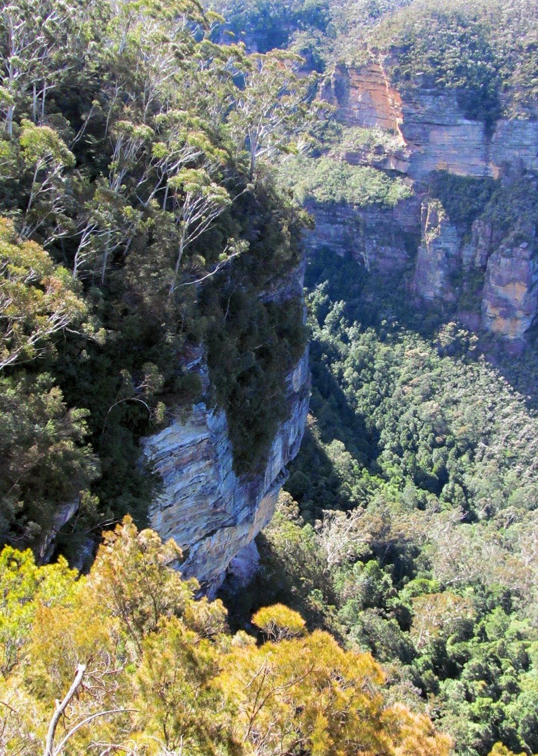
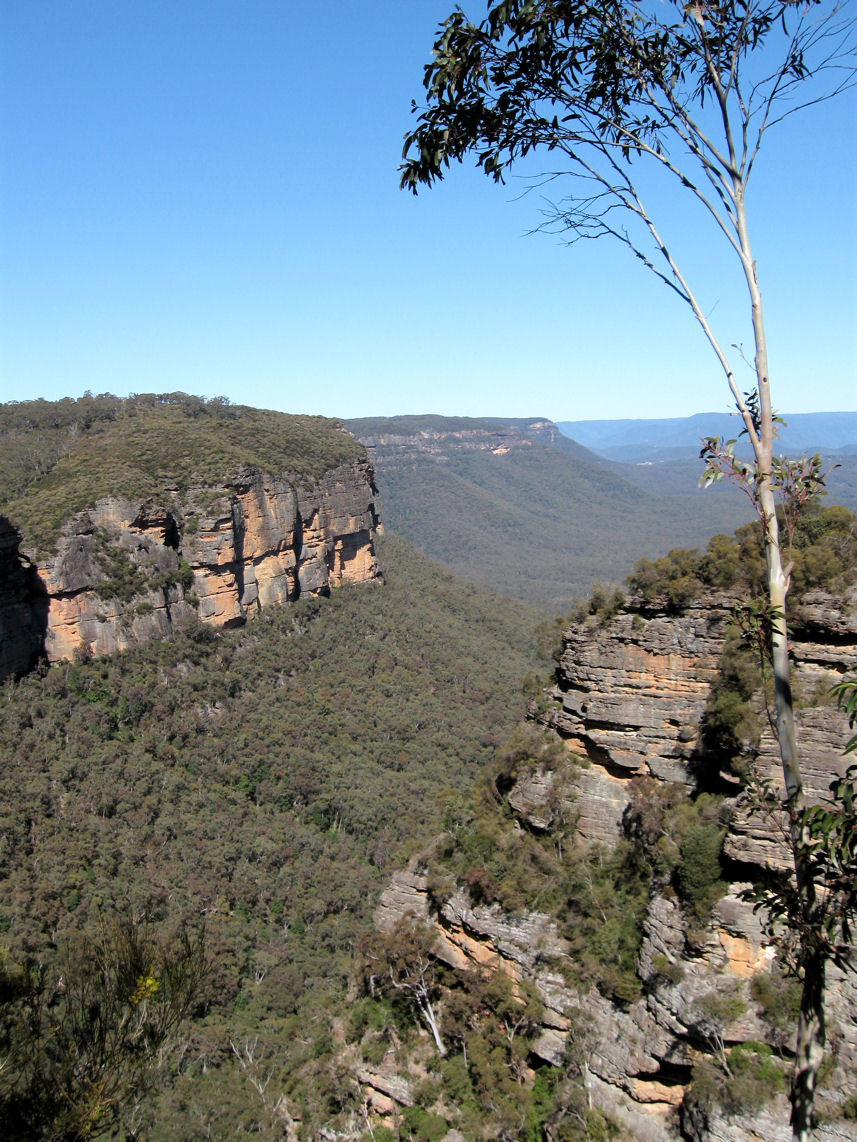
Bush walk
We had a easy day on this visit, but you can you can find sanctuary from the crowd on the pleasant walking trails which lead from Echo Point. Ask at the tourist centre for more information about bushwalks.

One popular walk, with great views along the way, is part of the Prince Henry Cliff Walk around the cliff line to Scenic World. Allow an hour and a half if you do this walk which starts near the path that leads to the lower viewing platform, down a gentle sloping concrete ramp. (see footnote). Towards the end of the walk the track comes out of bushland for a short section of Cliff Drive where you could stop for refreshments at Katoomba Falls Kiosk. There is a bus stop near the Kiosk.
The walk continues to Scenic World where you could catch a bus back to the station or you may choose to go on the Scenic railway (the world's steepest railway) or Skyway.


Katoomba Falls from Skyway


Katoomba Falls Cafe

Footnote: Don’t confuse this walk with the hard grade walk to the same location (via parts of the Dardanelles Pass and Federal Pass tracks) which starts at the Giant Stairway with 900 steps down to the base of the cliff.