Oct 19, 2012

Bonnie Doon Cliff Walk

We started this Katoomba walk at the Explorers Tree near the Great Western Highway, at Nellies Glen Road, about 2.5Km from the railway station.

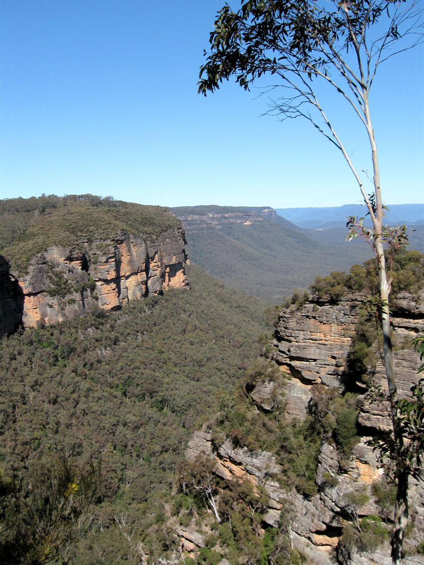
View from Norths Lookout, Katoomba
Nellies Glen Road, which we turned off to follow this cliff top walk, leads to the start of the 'Six Foot Track' and into the valley. Our walk featured Norths Lookout, which overlooks Nellies Glen and the Megalong valley.


Returning to the town centre through Catalina Park (Walford Park) we saw what remains of the Catalina Racing Circuit (below left), which closed in the 1990s. It has a disturbing history, as in 1957 "the traditional owners were forcibly removed from the Gully to make way for a racetrack". This site, known as 'The Gully' was declared an official Aboriginal Place in 2002.


Enlarged photos of the sign the walkers are reading

Location map

WildWalks link


Our thanks, as always, go to our walk leaders.

Oct 1, 2012

Watsons Bay and Sydney's South Head

  We arrived by ferry at Watsons Bay on Sydney Harbour, as an extension to our visit to Garden Island.

Watsons Bay, Sydney Harbour

          We walked along the beach, passing through Green Point Reserve to Camp Cove, then followed the South Head Heritage Trail which starts at the end of the beach.

Camp Cove, Sydney Harbour


The Hornby Lighthouse at South Head, was built following the loss of many lives from two ship wreaks in 1857.

The gun emplacements, completed in 1854, were never equipped with guns. In the photo below we are looking across to North Head.


Location Map             Wildwalks info.               

Sep 3, 2012

Glenbrook Creek to Red Hands Cave

To vary this well known walk in the lower Blue Mountains, our group descended to Glenbrook Creek down the steep slope from the West Glenbrook Nature Reserve (below left).


We followed the creek (above right) to the causeway. The track along the creek was overgrown until after Blue Pool, and although its picturesque, you don't have to reach the causeway by this route.     (see the links at the bottom of the page).

                  
                                      Glenbrook Creek (above)     Campfire Creek (below)


From the causeway we walked the Campfire Creek track to Red Hands Cave, before returning to the station along Bruce Road via the park entrance.      


             Location map

    NSW National Parks: Red Hands Cave            Wildwalks link     


Aug 11, 2012

Taronga Zoo to Clifton Gardens

We started this harbour side walk by catching a ferry to Taronga Zoo wharf. We first walked part of the Curlew Camp Artist's Walk in Sirius Cove Reserve, before retracing our steps.           Location map 
          

From the wharf we followed the path past the lower Zoo entrance to Bradley's Head. A 'Memorial Mast' dominates Bradley's Head. The mast was removed from Sydney (I) when decommissioned in 1928, and was erected at Bradley's Head in 1934. The memorial represents a mark of respect and recognition of the Australian officers, sailors and ships lost at sea and in combat

HMAS Sydney (II) Memorial plaque

Fig tree, Bradley's Head

     Bradley's Head also has stonework from old military fortifications (see info at Mosman CEFE)

Taylors Bay, Sydney Harbour

Clifton Gardens Reserve, Chowder Bay

This is a 5 Km walk took us through part of Sydney Harbour National Park (map and audio tour). At Cliffton Gardens we caught a 244 bus back from Chowder Head Bay Road to the City. You could also return to the Zoo wharf, see WildWalks.

My thanks to our leaders for this very picturesque walk. While this post is another Sydney walk, we have not stopped walking in the Blue Mountains, having recently walked at Springwood, and revisited the Witches Leap walk at Katoomba.