Nov 7, 2010

Blackheath Rhododendron Gardens


The eight hectare 'Campbell Rhododendron Gardens' at Blackheath in the upper Blue Mountains was established by the Blue Mountains Rhododendron Society and is maintained by volunteers. The site is much larger than this and has walking trails around the garden and bushland.

One of the things that struck me when visiting was the good effect of the exotic plants set within the Australian bushland.


Waratahs


April - May and September to November are likely to be the best times of the year to visit, but it is open all year.

The garden features a large pond and tranquil areas suitable for a picnic. Admission was just $5 (2024) at the Information Booth.

Location map


Oct 30, 2010

'Kirkbride' - Callan Park (2)

The 'Kirkbride' block, built in 1885, covers five hectares. It was part of the original ‘Callan Park Hospital for the Insane’


The buildings are built with sandstone mainly quarried on site and have slate roofs.
When Kirkbride opened in 1884 it represented reform in psychiatric practice, being the first to be designed as a curative and therapeutic environment based. Conditions at the hospital deteriated latter on, I am told.

It was named after Dr Thomas Kirkbride an American advocate for the mentally ill.


"Kirkbride features a pavilion-type plan, arranged around interlinked courtyards. Sunlight and air were seen to bring general moral benefits to asylum patients, and the buildings are well-lit and airy and open onto verandahs that link the various courtyards."

The original furnace stack is seen beyond the courtyard (right). The furnace was used to generate steam for the laundry.
The Kirkbride complex continued to be used for patients until 1994.
It was transferred to the Sydney College of the Arts in 1996 after renovations and restoration work and is now part of the University of Sydney.


Overlooking the site is the Venetian ‘clock tower’ which has a tidal ball copper spire on top, which rises and falls according to the water level of the underground reservoir below. Water entered the two underground tanks collected from the surrounding roofs, via downpipes concealed as Doric columns supporting the verandahs, and was pumped into two large cast iron water in the tower. The water was then gravity fed to the wards, with the upper tank reserved for any fire emergency. While there is provision for clocks, they were never installed.


 Reference: SCA pdf booklet 'Kirkbride - Past and Present'                  SCA transport information link

The Historic Houses Trust conducted tours of SCA in November as part of  'Sydney Open'

Oct 17, 2010

Mt. Victoria - Cox’s Cave

This Blue Mountains bush walk at Mt. Victoria starts at Mt. Piddington Reserve, which is about 2Kms from the railway station. The train journey from Central takes around 2¼ hrs.

Mt.Piddington lookout (near Mt.Victoria)


Mt. Piddington at 1,094 metres, is the highest lookout in the Blue Mountains. 


This photo (right) was taken on the walk, not far from Cox's Cave.


The walk from here to Fairy Bower Picnic area via Cox's Cave took us down uneven mossy steps to a moist gully. 
It is advisable to have at least three people in your group when attempting bush walks such as this one, in case there is an emergency. 


Some of our group took the optional side trip to see Cox’s Cave close up. This involved a potentially perilous climb up the 20 pipe-like rungs of a steel ladder. At the top we then crawled away to the left on a ledge, before being able to stand and walk the short distance to the cave.

I think the cave is named after the pioneer William Cox who was superintended the building of the road over the Blue Mountains which was completed in 1815.  

We continued the walk to the Fairy Bower Picnic area where the road leads back to the highway and the station.


Cox's Cave, Mt. Victoria


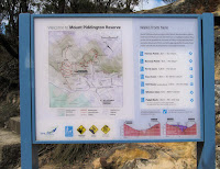
BMCC map of walks in the 
Mt. Piddington Reserve


My thanks to Judith H. for leading us on this interesting walk 

Oct 10, 2010

Callan Park - Lilyfield (1)

The 100acre plus 'Callan Park' property was purchased by the Colonial Government in 1873 for construction of a Hospital for the Insane, to be designed according to the enlightened views of the American Dr Thomas Kirkbride. It received its first patients in October 1884. 

Head Gardener's Cottage, Callan Park (1879)
The colonial architect James Barnet chose the Callan Park site for the new hospital as it was exposed to winter sun and summer breezes, was close to the city, and was isolated by the nature of its boundaries. 
The site also had a long north-facing frontage to Iron Cove. 


Iron Cove Bridge from Callan Point
In 1976 Callan Park Hospital was amalgamated with the adjoining Broughton Hall Psychiatric Clinic and become known as the Rozelle Hospital. In April 2008 the hospital was closed and staff and patients were transferred to a mental facility at Concord Hospital. 

Leichhardt Council recently released a draft master plan for Callan Park, on which people were invited to comment.


A plaque says this War Memorial (near Callan Park Oval), was erected by patients of B Ward.
It appears to cover a well.

 More info:
Friends of Callan Park
Draft Master Plan for Callan Park

Location map


The main entrance to Sydney College of the Arts.
See my post on 'Kirkbride'

See also my 'Iron Cove Bay' post