Jul 27, 2011

Penrith - Nepean River Walk

This walk started on the western side of the Nepean River at River Road Reserve Emu Plains, crossed over the Nepean Valley Bridge to Tench Reserve, a popular picnic spot on the eastern side of the river.


About half way along River Road Emu Plains, is the Penrith Regional Gallery (below). This was once a small rural property that became the home of artists Margo and Gerald Lewers. Their daughters donated the site, buildings and gardens along with an art collection to Penrith City Council. We stopped here for refreshments at ‘CafĂ© at Lewers’, which has a pleasant outlook of the cottage garden.

Lewers Gallery Emu Plains


The front door of Lewers Gallery and a sculpture by Sonia Farley, made from Banksia wood from the collection at Penrith Regional Gallery & The Lewers Bequest


Rail bridge over Nepean River, Penrith

                                 Walk location map                                                                   


We turned away from Tench Reserve at Jamison Road and walked on to Panthers Leagues Club.
There is a limited bus service from here, see Blue Mountains bus services.

There is also another walk along the river, under the Victoria Bridge (road) and the adjacent 1907 Rail Bridge (see above photo) past the weir reserve. This walk is a short distance from Penrith shopping centre.

Nepean Belle have boat cruises that extend into the Nepean Gorge.

Jul 10, 2011

Lavender Bay

We started this walk at Waverton Station following Balls Head Road, past HMAS Waterhen to Balls Head Reserve.


I had heard this park mentioned from time to time, but this was my first visit to the nine hectare reserve,1.5Km across the water from Sydney’s CBD.  Before reaching the reserve we walked through one of the tunnels (above) of what was a coal loading facility until 1992.

On the eastern side of Balls Head, on Berrys Bay, is the former BP oil storage depot (tank cutting, right).  

In January 2003, the NSW Government rezoned the BP site for open space and placed it under the care and management of North Sydney Council. Thirty one storage tanks were removed from the site in 1996. The parkland, now known as Carradah Park, were opened in March 2005.


Along the Lavender Bay foreshore, between Luna Park and Quiberie Park is a series of miniature sculptures: 'Hidden Treasures' by the artist Peter Kingston. They are based on iconic Australian comic characters such as The Magic Pudding (below left), from Norman Lindsay's classic children's book.


Beyond Quiberie Park is a pathway that leads past Luna Park (above right). I finished the foreshore walk at this point and caught a train from the nearby Milsons Point Station.


Location Map                                        Additional Photos                                    Walking Route Map

Jun 24, 2011

Glenbrook Lagoon

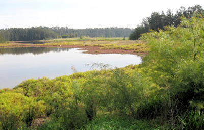
Glenbrook Lagoon, in the lower Blue Mountains, is a rare upland wetland within the Hawkesbury-Nepean system, and provides habitat for flora and fauna species that are otherwise unusual in the area.


The lagoon was described during the historical crossing of the Blue Mountains by Blaxland, Wentworth and Lawson. In the late 1860’s the lagoon was resumed from the lands of Barnett Levy by the railways, and the storage capacity increased with the construction of a low dam (see road photo below) to provide water during the construction of the railway across the Blue Mountains. During the 1870’s water from the lagoon was used for the mountains (steam) trains.


Purple Swamphens (right) live in the marshes around the lagoon.


The lagoon is about 25 minutes walk from Glenbrook and Blaxland stations. There is a walking track around the lagoon, with parking off Glenbrook Drive near Olivet Street.


It is a further 2Km walk to Lennox bridge (above right), via Kodala Lane which connects Glenbrook Road to Kedron Steet. The photo above (left) shows the rough trail from the end of High Street to Lennox bridge on Mitchell’s Pass. The bridge built by David Lennox from sandstone quarried nearby, is the oldest stone arch bridge on the mainland, completed in 1833. 


There is a Lennox bridge both in the the Blue Mountains and also in Parramatta, as Joan Elizabeth pointed out in a comment to my Parramatta post.


A small shopping centre with restaurants, take away shops and a hotel is located near the lagoon at Kidman Street, off the Great Western highway.  Blue Mountains buses (route 690) is the local bus service.

Glenbrook Lagoon Bushcare Group.

Jun 11, 2011

Bicentennial Park

    Badu Mangrove Board-walk and Coastal Saltmarsh


Sydney's Bicentennial Park is just west of Concord West station (about 15Kms from Central station) and is adjacent to Sydney Olympic Park. The Badu Mangrove boardwalk enables people to walk through the largest remaining mangrove ecosystem along the Parramatta River.


A coastal saltmarsh is a salt-tolerant plant community that lives between high and low tide, often behind mangroves.


On our visit, the air had a smoky haze from hazard reduction burning in the Blue Mountains the previous day.


The parklands contain diverse habitats for many plants and animals that are significant locally, nationally and internationally. These include rare saltmarsh communities, breeding populations of insectivorous bats and endangered Green and Gold Bell frogs. Species of migratory birds protected under international treaties also often roost and feed in saltmarsh during their stay in Australia.


Further information about Coastal saltmarshes: pdf download from NSW Dept of Enviroment


Homebush Bay


   The Brickpit Ring Walk


The Ring Walk is within Sydney Olympic Park,  was opened in 2006. It is an elevated circular walkway which allows visitors access to view the former brickpit area without disturbing the habitat of the endangered Green and Golden Bell frogs.

The Ring Walk, is 550 metres in circumference and is 18.5 metres above the floor of the Brickpit.
The original audio has packed it in, but the informative panels around the side are in good condition. They give a history and geology of  the Brickpit and information on the frogs.

My thanks to Jean B. for leading us on this interesting walk