Sep 11, 2015

The Spit to Manly

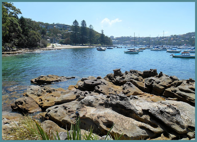
This popular walk from The Spit Bridge, Mosman, meanders around the harbour foreshore of Clontarf, through part of Sydney Harbour National Park, to Fairlight and Manly.

The Spit Bridge, Middle Harbour
The Spit Bridge (completed in 1958) opens several times each day to allow the passage of tall-masted vessels.


This scenic 10 Km walk has numerous entrance/exit points which would enable a shorter walk.

We caught a bus from the city and returned by ferry.


          The Manly Scenic Walkway   map and info

           Walking Coastal Sydney also has a good pdf with map and notes

            WildWalks link


Aug 2, 2015

Centennial Park and Labyrinth

On this return visit to Sydney's beautiful Centennial Park, I was looking forward in seeing the 260m sandstone labyrinth. Unlike a maze, a labyrinth has a single pathway leading to the centre. There are more than 1,700 stones of 80 different shapes and sizes in the pathway designed for quiet reflection and exploration.


The weather was cold and showers threatened, but I enjoyed my visit none the less.


The Labyrinth, which was opened in September 2014, was featured in an ABC 'Compass' program 'Walk The Talk'


 Centennial Park Labyrinth 
      Sydney Labyrinth                 park location map   

Link to my previous Centennial Park blog post


Jul 9, 2015

Lane Cove River

Pond near Tarban Creek, Huntleys Cove

This walk, which began at Huntleys Point wharf on the Parramatta River, was a new one for me. It followed a section of the Great Northern Walk along the Lane Cove River, to West Chatswood.

Tarban Creek bridge from Huntleys Cove

Lane Cove River
At Epping Road, North Ryde, we crossed under the Lane Cove River Bridge. (above)
------------------------------------------------------------
A little to the north of this, and within Lane Cove Nation Park, is a site once known as the Fairyland Pleasure Grounds - 'a place of mystery and beauty' - the clearing on the banks of the river, once featured a picnic ground, dance hall, flying-fox etc. It dates from 1913, and remained in use until the early 1970s. (below)


We ended our 10.9km walk at Delhi Rd near Fullers bridge, and caught a bus to Chatswood station. My thanks to our walk leader.
                                                 

          location map  (Huntleys Point)           location map  (Lane Cove)        


May 2, 2015

Bicentennial Park

We stated our walk to the Homebush Bay - Badu Mangrove section of Bicentennial Park, at Rhodes Station. We followed the track alongside Homebush Bay Drive, before exploring the section of track between Powells Creek and the Billabong.  

Homebush Bay from Bicentennial Park


We shouldn't have been surprised when we encountered mosquitoes in the area between the creek and the billabong (photos left & below).

(above left) 'Warrigal Greens' (a bush food), growing next to Powells Creek.

(above right) Black Swans in the waterbird refuge
Billabong, Bicentennial Park


The wreak of  various ships can be seen from the 'Shipwreck Lookout', which juts out into Homebush Bay. The reason for this, is that part of the bay was once used as a ship-breaking yard.


Rhodes is about 17kms from Central Sydney. You could also start or finish from Concord West. This was a return visit for me -
Link to my previous post on Bicentennial Park