Pages

Oct 30, 2011

Warrimoo to Sun Valley

On this walk we followed fire trails through the valleys near Warrimoo in the lower Blue Mountains.


Sun Valley is a small, somewhat hidden semi-rural community, not far from Springwood.

Sun Valley Oval & Reserve

Sun Valley Oval (above) is an open area used by the local pony club.  Sun Valley is an unusual landscape, the result of a volcanic vent. The very rich soils have provided excellent native grasslands and magnificent stands of Mountain Blue Gum trees. Reference: Bruce Cameron, Sun Valley, 'The Dictionary of Sydney'


We started this walk at Warrimoo station and walked along Rickard Road, then followed various firetrails through the valley to meet Rosenthel Lane, Sun Valley. We returned to Valley Heights station following a rough reserve track (above) uphill to 'The Chase', then 'The Valley Road'.

Thanks to Judith who showed us this less well known walk.   
                                                        

Oct 23, 2011

University of Sydney


The University of Sydney Quadrangle Building is glimpsed in this photo from Victoria Park Camperdown. (near the intersection of City Rd. and Parramatta Rd.) 

Lake Northam, Vistoria Park, Camperdown

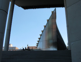
Sydney Law School moved from its Phillip Street building to a new building (below) on the main campus near Fisher Library. It was completed in 2009.


Sydney University's Parramatta Road Gate Lodge (also known as Baxter's Lodge) and gates (below). The Gothic revival style gatehouse was constructed in 1939 - 1940, when the University entrance was changed from the original location, which is now part of Victoria Park.

Oct 13, 2011

Hawkesbury River Postman

For this excursion we joined a group of sightseers for a cruise of around three or four hours along the Hawkesbury River, with the ferry skipper giving us a commentary.

Hawkesbury River

On weekdays, 'The Riverboat Postman' provided milk, mail and other supplies to homes along the Hawkesbury River, 50Km north of Sydney.  The ferry service we went on finished in April 2012, but a new operator was expected to take over.


Dangar Island

The train took about one hour from Central Station, with the town (Brooklyn) only a few minutes walk from Hawkesbury River railway station.

      Location Map

Oct 5, 2011

The Ponds Walk

We started the 6.6Km walk at Memorial Park, Marsden Rd. Carlingford. The track passes through Dundas Valley and Telopea, following The Ponds and Subiaco Creeks downhill to Rydalmere.

Galaringi Reserve, Carlingford


This is one of the ponds (above and left) that gives the creek its name.


This is an urban walk, about 15Km from Sydney CBD.
Beyond Galaringa Reserve and Cox Park at Carlingford, the bushland associated with the creeks is quite narrow, so we were walking along a winding green corridor for much of the walk.
It should not be confused with any walk in the suburb of 'The Ponds' near Kellyville


To reach the start of the walk we caught a M54 bus from Parramatta station, along Pennant Hills Rd. to Carlingford (near Marsden Rd.)
The track ends not far from Victoria Rd. at Rydalmere. We returned by bus from there, while the Subiaco Creek flowed a little further to enter the Parramatta River.


Downloadable brochure of the walk available from: Parramatta City Council
Location map